Flight Log
Between life and the (fabulous) weather lately, it has been almost a month since I got to take the drone out and get some flight and pictures. Luckily that ended today (5-21-2021). On the advice of UAV Coach, I went out with the family and flew the Lynn Woods.
The weather was great (though it did rain as we were heading back to car). I got the chance to try out the new drone backpack I bought and we headed up the path to the Stone Tower. Ultimately, I got to try a few new things out as I did two smaller flights:
Flight 1 – Walden Pond
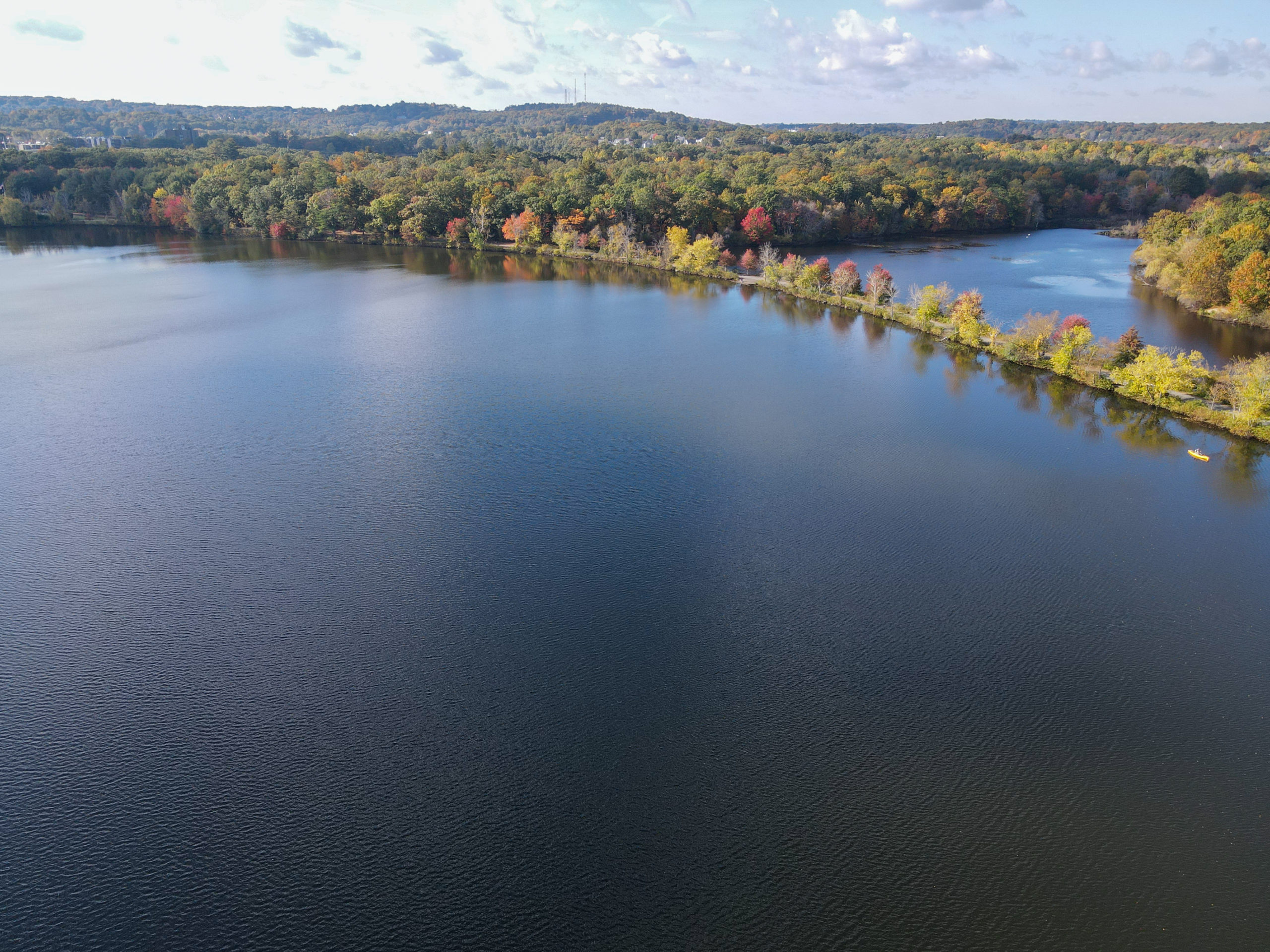
I did the first flight almost right away. We arrived, parked in the lot and started walking up the hill and immediately noticed a cool little cut out the little Penaug’s wanted to play at by Walden pond (different Walden Pond, this one’s in the Lynn Woods). While standing there, I realized there wasn’t really anyone along the bank and it there was a really good spot to take off. I checked Airmap, and where we were was actually in uncontrolled airspace, so I moved off to a clear area and took off!
I got to fly about 20 minutes while the kids played. The drone went right over Walden Pond, which was a new experience for me (and slightly terrifying), but ultimately no different then land. I managed to get some really cool pictures.
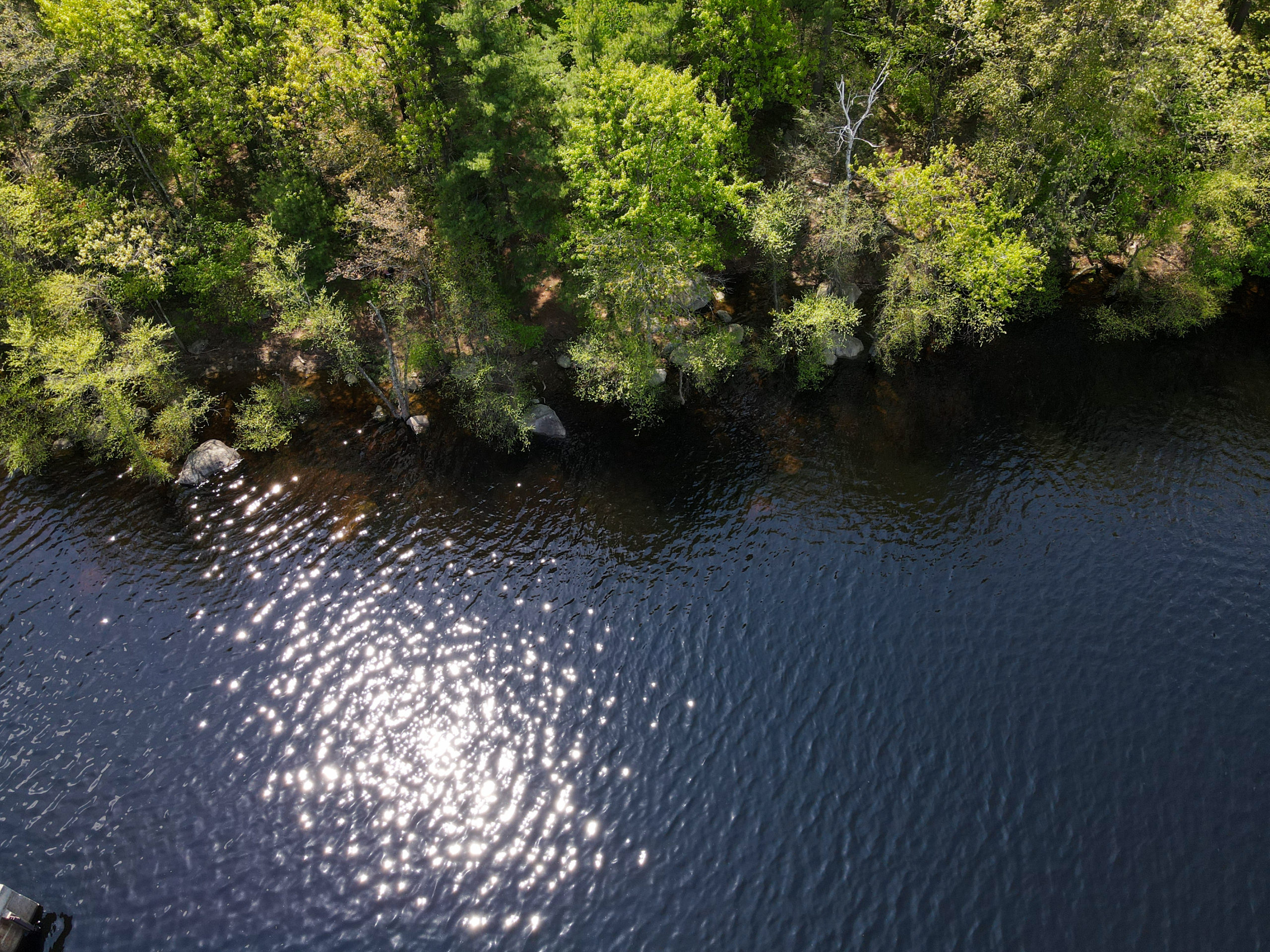
Ultimately, flying over the water is pretty easy. The line of sight was actually simpler and I didn’t have to worry about people walking by. I also got some really cool pictures from it.
Flight 2 – Burrell Hill/The Stone Tower
After finishing up down by the pond, we continued up the trail to The Stone Tower.
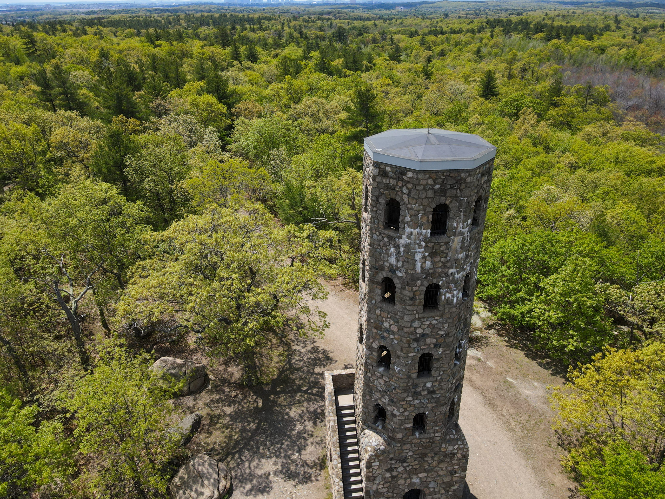
This was a pretty cool little area. Elevated 285 feet over the start of the trail, it also had a wide open clearing next to it perfect for liftoff. Luckily, despite the nice weather not many people were around so it was safe to fly.
This was where the next of my firsts for the day. After checking Airmap, I discovered the tower is in Class B restricted airspace due to being in proximity to Boston Logan airport.
LAANC Authorization
What this means is I had to file a flight plan and request authorization via the FAA’s LAANC system. Thankfully, I knew this before I went and had been expecting it. I signed up for the Airmap app and installed it on my phone, which is an approved FAA app for requesting automated LAANC authorization. Once I was on site, I simply opened the app and filled out a simple form. This was pretty easy and just required a few things like:
- Setting a radius and maximum height for the flight (in the class B area I was in, the maximum height was actually lowered to 300 from 400 by FAA even with LAANC)
- Duration of the flight
- Name and phone number of operator
- Weight of drone
- Some basic confirmation questions like “Are you going to fly over people?” and “Are you flying line of sight?”
Once you do all this, Airmap gives you a pre-submit screen where they actually tell you whether it is likely to get approved. For example, the first time I didn’t add my phone number, and it told me I was going to get denied without it. The app also gives you prompts for any preflight items you’ll need.
After submitting, it took about 60 seconds for me to get a text from Logan saying I was authorized and giving me a confirmation code. Even better, Airmap saves the code under my flights for later. I may actually try and figure out how to use Airmap for all my flights because it’s so nice to read the logs there.
Taking Off!
Once I had the confirmation, I was good to fly! It was actually really fun flying around the tower. I also was up on Burrell hill, so I was able to get some cool forest landscape shots as well, by flying about 150-200 feet above where I took off from (which was already 285 feet in the air).
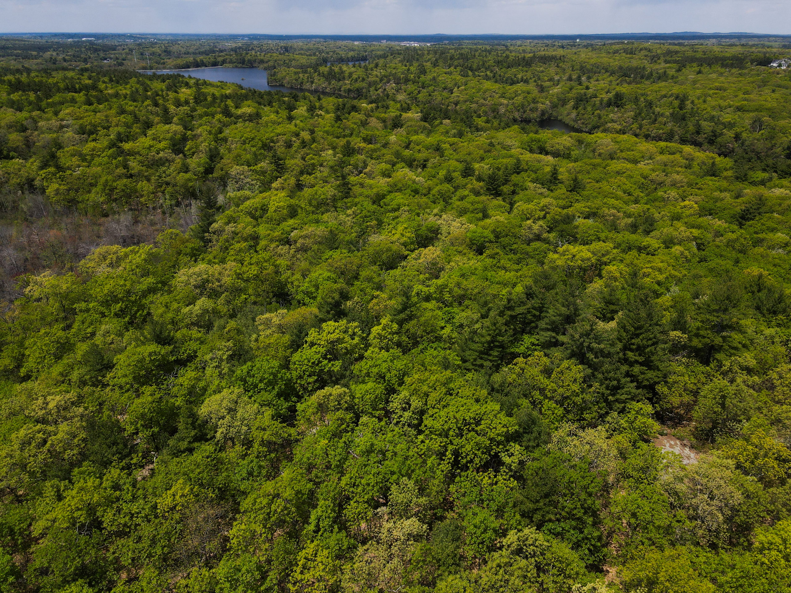
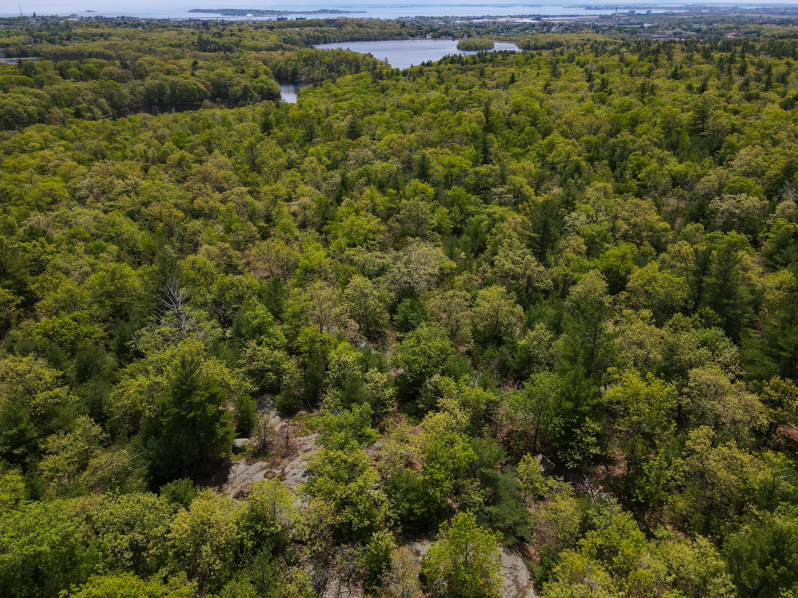
Ultimately, I got to fly about 20 minutes and take some good shots. After that, some people started to wander in. I was probably safe to keep going, but I had gotten the pictures I wanted and out of an abundance of caution, decided to land.
Some Learnings
I learned a few really key things during this flight.
First, LAANC is nothing to be scared of. It was incredibly easy and painless (at least in class B). Given all the locations near the city, this was great to learn.
Second – droning and hiking are definitely a blast together, and I am really glad I bought that backpack. It was a lot of fun having a goal to the hike, and flying the drone well away from people is just, well, easier.
The third and final lesson is I need to learn to use my filters. When taking photos, I discovered if I wasn’t facing at least somewhat tilted down, the amount of light would really effect the outcome. This is resulting in a lot of angled photos where I’d prefer more of a horizon look. I was still able to take these photos, but they look later in day – case in point:
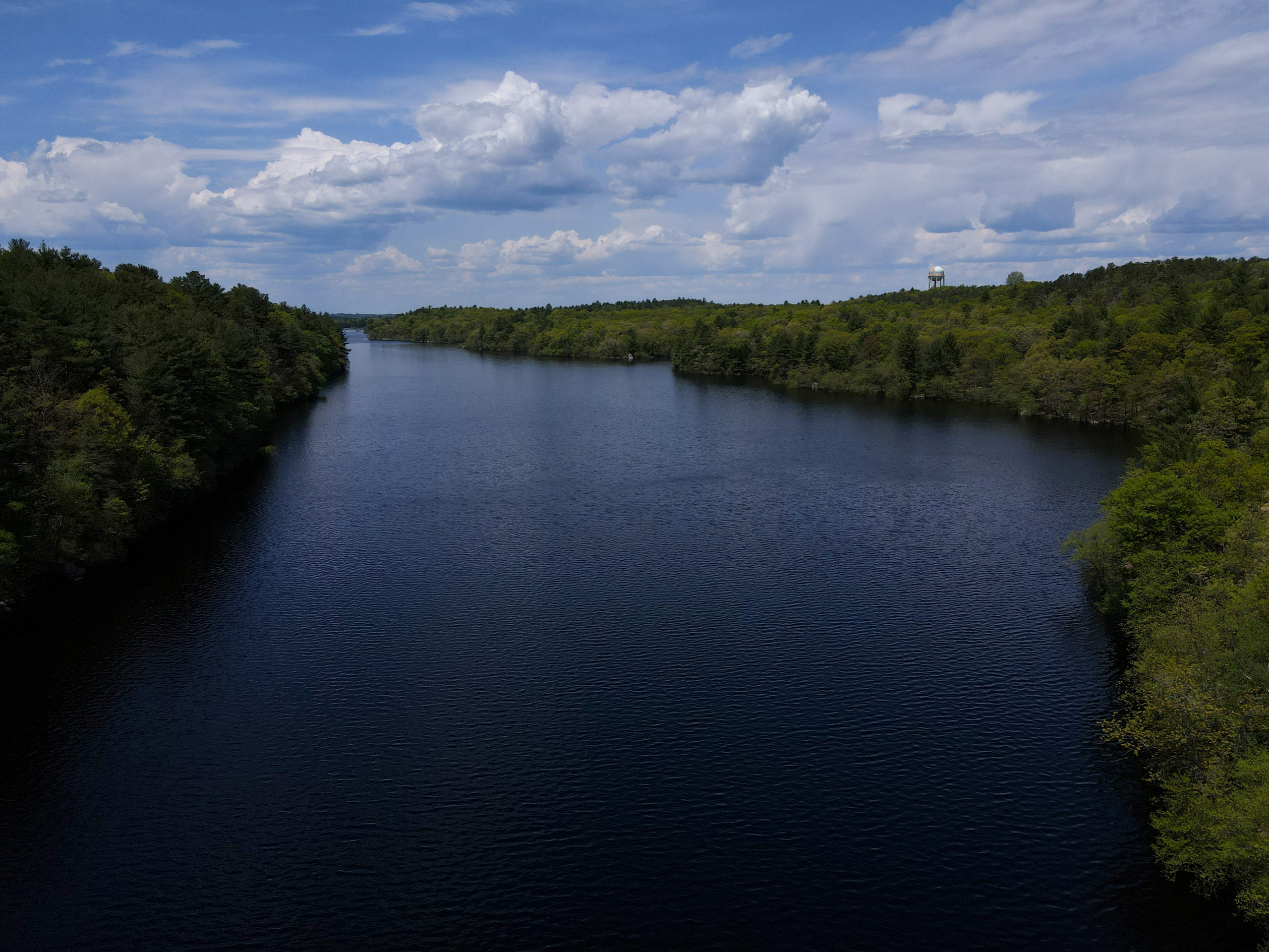
I actually love how this photo came out, but I think with the right filter I would have captured more of the vibrancy of the day.
You can see all my Lynn Woods photos in this gallery!